
Have you ever wondered why a place you confidently remember from childhood, at a position on the map suddenly changed its location? You might have also heard Sri Lanka moving from its original position right?
Some people from ’80s remember studying, discussing or researching on the location of Sri Lanka on different purposes as a place somewhere near west to India. Many people from ’90s remember its location as exact south to India. And now when you pick up a map or search online, you would find this towards the south west of India.
Heard of wanderers -people traveling from place to place but don’t settle or stay at one place for long. But this, Is this a wandering country!?
This not particularly happened to Sri Lanka alone, people also remember such geographic changes in other countries or places like Andorra, Cuba, Denmark and Sweden, Korea, Japan, Mongolia, New Zealand, Oceania, Poland, and Portugal.
A 1993s, American coming-of-age comedy movie, Dazed and Confused have a scene where a picture of globe can be seen. The interesting part in this is the map on the globe is quite changed and different from today’s satellite view of that place.

The picture of the globe can be seen in the image above and the satellite view in the image below.

Moving Countries:
Denmark:
People claim to remember the sea between Denmark and Sweden and Sweden was never this close to Denmark, as it is now.
A user named u/xhin made a comment, “Sweden and Norway were definitely not touching Denmark.. there was a huge sea there in between them. This is a very recent change! I remember a big sea there as little as five years ago. It’s like Sweden and Norway are “bent” over, I guess to make room for.”

Some other people remember a short bridge, a ferry where recently the bridge was built. They claim to travel on this bridge which took only a few minutes to cross.
Another unknown user says, “ They have always been that close. As a regular visitor to Sweden and Denmark, I can speak for them too. I’ve been traveling there regularly since 2004, and that whole time Sweden and Denmark have been so close together that they have a bridge linking them that takes minutes to cross.”

Korea:
A similar case was found about Korea when someone came up with the map of the old Korea they remembered and people started relating their experiences to this map. They claim that in their memories, Korea was never like this as it seems today.
Someone with a username ‘alanwescoat’ posted “Try living here in Korea and witnessing the daily changes to the landscape…lol. A few weeks ago, my daughter woke me up to tell me that the islands outside our window had moved again, which they had in relation to our memories of them, though, of course, as is always the case with the Mandela Effect, those islands have always been where they currently are, and should they move again, they will always have been in their new locations as well…lol.
What if instead of actually moving Korea, we just take that massive bulge out of China to bring Korea closer to southeast Asia? Think of it as China having grown rather than as Korea has moved in relation to what you remember. Certainly, I never saw the Bohai Sea on any map until this past August when a whole lot of people were noticing geographic changes. Now, of course, Taoist legends regarding the Immortals place them as having inhabited islands in the Bohai Sea. Heh. It is really hard to keep up with the retroactive continuity of the world as the surface expands and its history gets longer at the same time.
I recall that when I decided to move here over ten years ago, I looked at a map in my 1971 World Book encyclopedia and was surprised to find that Korea was specifically in East Asia rather than in or even close to southeast Asia.”

In the words of another user, furi0us_g, “Yeah, I had the same memory, all I knew was that Korea was north of Japan. It was very disconcerting seeing it next to Japan. Everything was a bit smaller too so that Japan, Okinawa, and the Philippines all fit between south of Korea and north of Indonesia. It’s almost like someone took those countries and used Photoshop to enlarge them.”
This mystery of Korea has remained as doubt and unanswered.
____________________________________________________________________________
Japan:
Japan is also recently known to move its position. People claim to remember it is a different position from where it stands now.
There’s a user named basurad00d who commented, “I spent a lot of time looking at Japan in Google Maps and Street View years ago, comparing its density with the British Isles’s density, and I can confirm that Japan didn’t use to be so close to Russia or Korea. You could zoom in on the computer and have a rectangle with Japan on there alone, with the surrounding ocean, now that’s impossible, there’s a big chunk of land in the picture.
It looks like this:
 Which look ridiculous, Japan used to be farther away and it would appear alone in those maps, surrounded by the ocean. No Russia, China or Korea on there.”
While another user named Jay B says, “It looks fairly accurate to me. The northern portion is adjacent to eastern Russia, southern portion roughly adjacent to both of Korea’s.
If it’s any help, I vaguely remember that Tokyo and Seoul were on roughly similar lines of latitude, and they still seem to be.”


New Zealand:
New zealand is counted among one of those moving countries for it was remembered to be shifting its position from North East of Australia to South East of Australia. People remember it a little bit closer to reach than it is now.

While some people claim it as an effect of mandela effect, some call it a result of geographic changes. Some people have experiences of reading about this or looking into maps but they found it in a different place and suddenly out of blue, it is in this new position. They are some people who call it a gradual change in our geography and getting a look at same place after long time gives a new view of that place.

Also some people say this is just a case of lack of proper knowledge. That the place was same from all this while and at same position. Nut incorrect mapping or lack of proper knowledge gives people a different description and thus they may think these changes happened which actually didn’t.
Changing Geography:
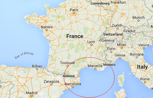
Andorra:
Many people don’t remember this small country, named Andorra, located between France and Spain. They are pretty sure and confident that they had subjects like geography, etc as their mainstream or they had a keen interest on maps but had never come across or heard of this nation.
Someone with a username ‘contactingthedead’ shared their views in the comment section of a blog and what they said was: “ That looks strange to me. I remember having to color and name each country in Europe for World History throughout the years.
Not once was this on the map. And if I find my old schoolwork and see where I colored this country in and wrote the name, I’ll freak out.”

Many others assure that they knew this Andorra as being a part of maps ever since they could remember, but maybe due to its small size, it may not be properly visible or have not been properly drawn on maps. There is also a probability that it might have got mistaken as one of the cities.
A user named ‘ClementineHearts’ replied to the same blog with “I think for most maps, it’s too small to actually be drawn in, so they just have the word ANDORRA printed there. But since a bunch of cities in Spain and France is printed around it, it’s easily mistaken as a city instead of a separate country.”
Being sixth smallest nation of Europe of just 468 square kilometers area and a population of 77,281 in approx, no doubt it could have been confused as one of the cities.
Cuba:
Cuba is a country located in the northern Caribbean, a place where the Caribbean Sea, Gulf of Mexico and the Atlantic Ocean meet. It comprises an island of Cuba, Isla de la and other small archipelagos. It is an area of 110,860 square kilometers.
Some people claim to remember Cuba in a different geographic structure. Something like a place of a lesser area and located somewhere further west to where it is now.
Someone named ‘Germanakzent’ shared their views on remembering Cuba as a different geographic structure from childhood, ”I always remember Cuba having a long tail to the west. As a kid, I thought it looked like a beaver or an otter diving east into the Atlantic. Definitely not new to me.”

But people from Cuba, the Cubans say that Cuba is not what others are picturing and it hasn’t changed at all and is as it was. But it has been put wrong on maps for a long time.
In the words of an unknown user,”I’m Cuban and sorry for this ME, but it’s mapping being super inaccurate. Originally sometimes Cuba was drawn way too big, or way too small. It’s actually only about the size of FL, probably even smaller than some sites lead on. The part on the west was always there but maps didn’t draw Cuba so directly under FL, but a bit to the right, I can confirm this has always been maps. As when I came to the US, I always thought how the heck can the southern key be only 90 miles to Havana, back then the internet wasn’t as accessible. So that’s when I noticed it was always drawn very poorly. Other ways it was drawn is, way more South East, way less or more tilted depending on what you’re comparing it too. For those that think it’s new land especially, more recent not only was it drawn more to the right it was usually looked way smaller to make a place for the Bahamas and such.”
Mongolia:
Mongolia has also came up to be onwe of the most interested topics regarding mandel effect. When one day someone came up with a question “Is mongolia a part of china, or for how and when did this happen?” this came into light.
A user named ‘mangolds’, stated,” For me, Mongolia was always part of China. I discovered that it’s its own country about the same time I learned it was a “confirmed” M.E. Mongolia is always where China sent dissidents to prison, similar to how Russia/USSR would send dissidents to Siberia. It’s also about the time I learned about a lot of geography changes, such as Australia and New Zealand moving around significantly and South America moving way east.’

Another user named ‘livingthereality’ clarified this as ,”You are thinking of Tibet. Mongolia has been a country for as long as I can remember. My last definite memory of it being a country was in 2006 but I knew it has been a country before that.”
This can thus be considered as a confusion for some or age gap due to which their subject content got changes and lead to this confusion.